|
|
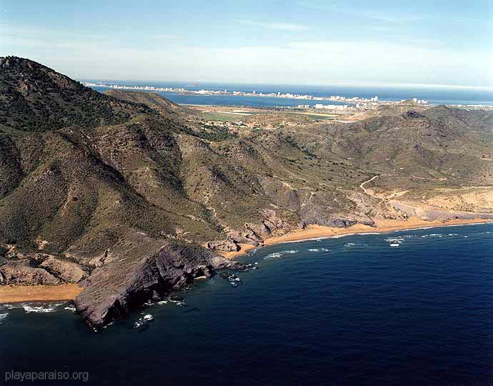
Calblanque
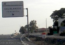 The only road access
is from the MU-312, just after you pass Los Belones, heading towards La Manga
strip (ie east). There is a single sign pointing to Calblanque. At the top of
the slip road you turn immediately right (across the service road) onto the
dirt road whch crosses a large field before reaching the first junction.
The only road access
is from the MU-312, just after you pass Los Belones, heading towards La Manga
strip (ie east). There is a single sign pointing to Calblanque. At the top of
the slip road you turn immediately right (across the service road) onto the
dirt road whch crosses a large field before reaching the first junction.
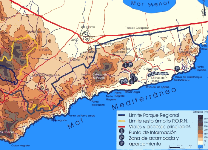
Maps of Calblanque tend to be a bit jumbled, with a mixture of roads, tracks and paths, but getting lost is quite good fun. Basically, at the first junction take the road to the left, to go to the salt beds and the largest beach. The road to the right takes you more into the centre of the park and two more beaches.
There are several covered parking areas and wooden walkways.
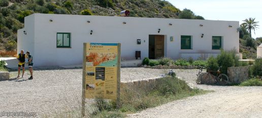
Information Centre (take the right
fork)
Calblanque Walks and other Features
Beaches Index
Other places to visit
 Please Click Here Please Click HereTo send comments and feedback about this site. |
Home - Full Site Index
(c)2006 C Edwards